13th – 15th May 2024
Day 1 – An Introduction to the Lower Firth of Clyde
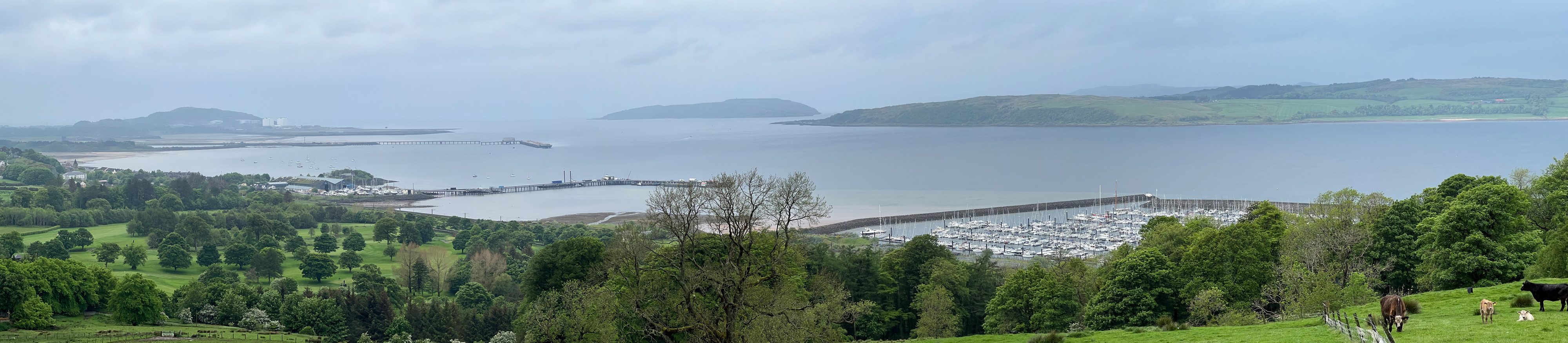
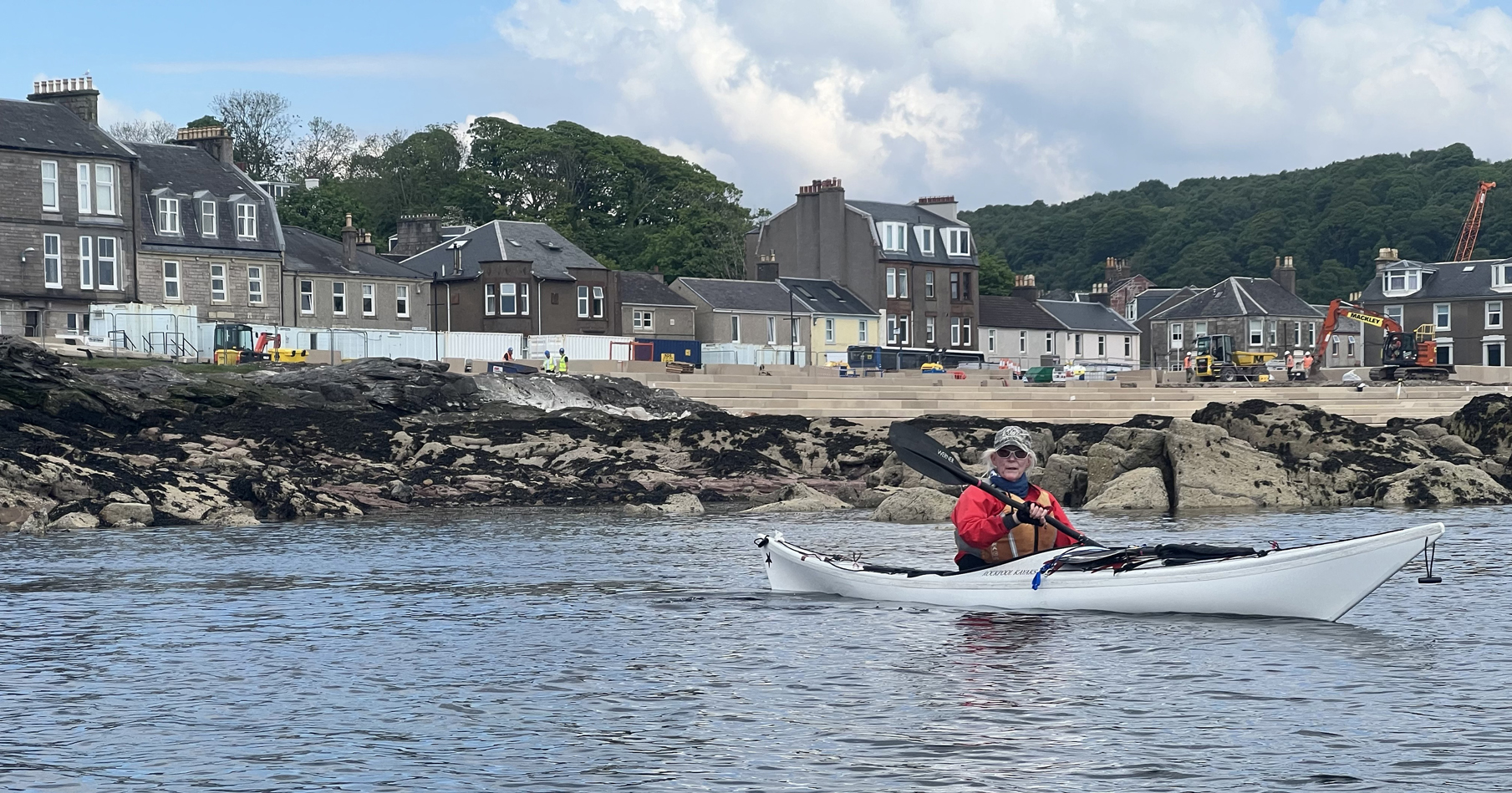
I drove up from Carlisle on the Monday morning. Kelburn Castle Campsite, near Largs Marina, was our base for the three days. The campsite had great views across the Fairlie Roads, to Little Cumbrae, Great Cumbrae and the Isle of Bute. Arran were somewhere in the distance. Barry and George were already there, tents pitched. Whilst I was pitching mine Annette, John and David arrived, all squeezed into Annette’s Mondeo. They were carrying on up the coast on Thursday to start a circumnavigation of the Isle of Bute. Then Ray arrived with his caravan. Team complete (Annette, Barry, David, George, John, Ray and myself (Tony). Tents pitched, a short drive to Largs Marina. The put-in was down an aptly named slip-way. Head north past Largs and explore the coastline, return but this time stop in Largs for an ice cream (Nardini’s). We continued south as far as the jetty before returning to Largs Marina. The rain held off as we loaded our kayaks, but it soon set in for the duration. Ray kindly offered to cook us a BBQ. We sat in his caravan, whilst he cooked outside. A very nice selection of meat and roasted vegetables. Thanks Ray, I do not think that you got too wet. A pleasant evening was spent checking weather and wind forecasts.
Day 2 – Playing the Tourist
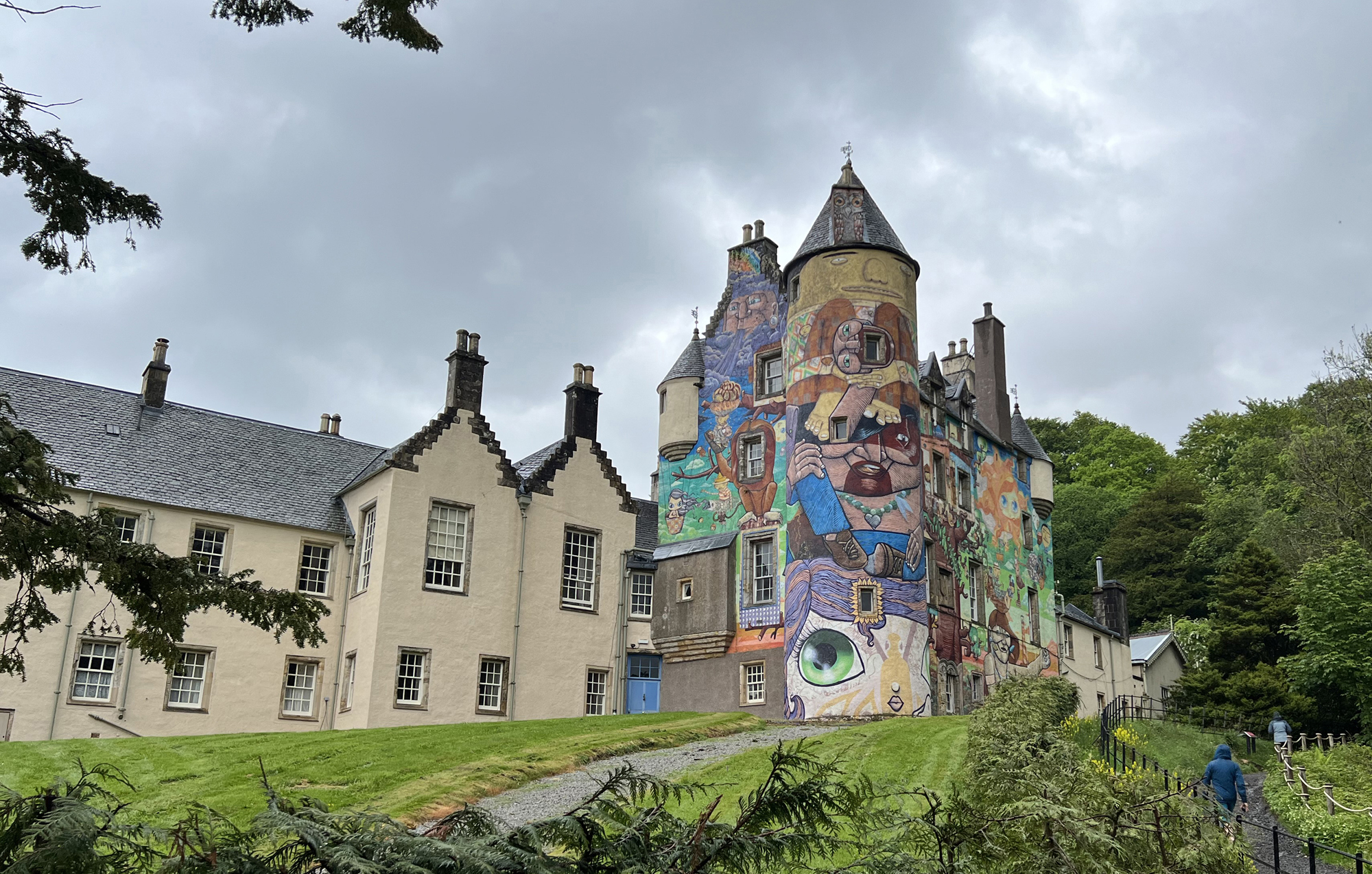
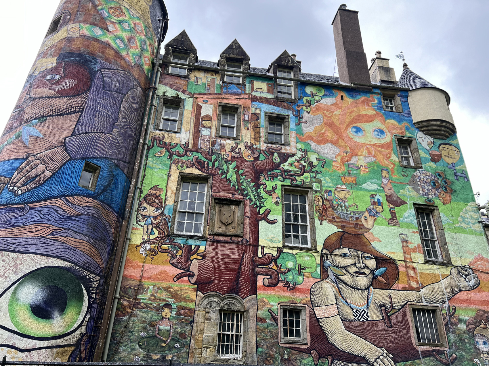
It had rained all night and there was an easterly wind, which brought several problems. To my inexperienced eyes the sea seemed OK, but I was told that you could only see the back of the waves. Problem number two was that you could not see the weather coming in. No surprise when a walk around the Kelburn Estate was proposed. Annette pointed out the many Islands that we couldn’t quite see through the clouds. The renowned painted Castle Graffiti is said to be on par with a Banksy. At least the cafe was open. Unsurprisingly we were their only customers. Refreshed we walked into Largs for a spot of sight seeing. There is a good cycleway all the way along the coast here. Past an avenue of old anchors, The Pencil (a monument commemorating a Viking Battle) and into the Marina. Scott’s for lunch and LargsChandlers for anything nautical. On into Largs for more ice cream. The wind had changed direction and I could definitely see the weather coming in. Back to our tents just before the rain started with a vengeance. A good decision by Annette and John. Scott’s booked for 7.30 pm. Another pleasant evening was spent checking weather and wind forecasts.
Day 3 – Circumnavigation of the Great Cumbrae Island
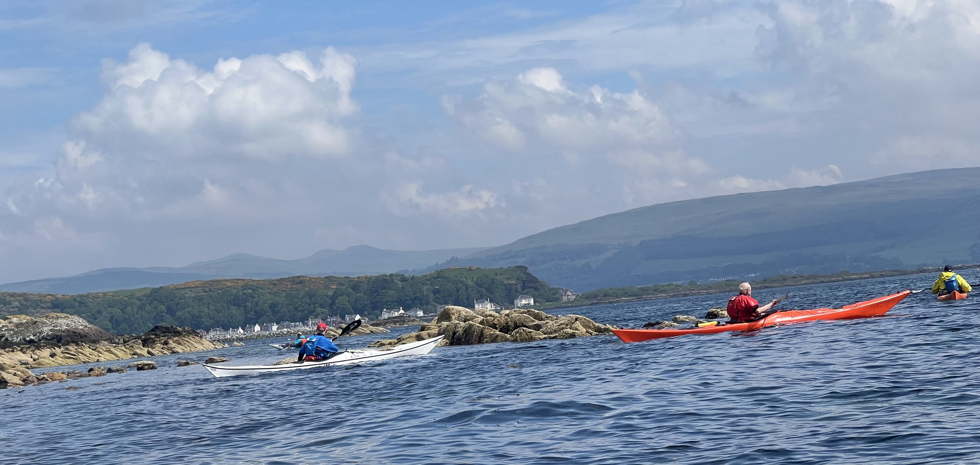
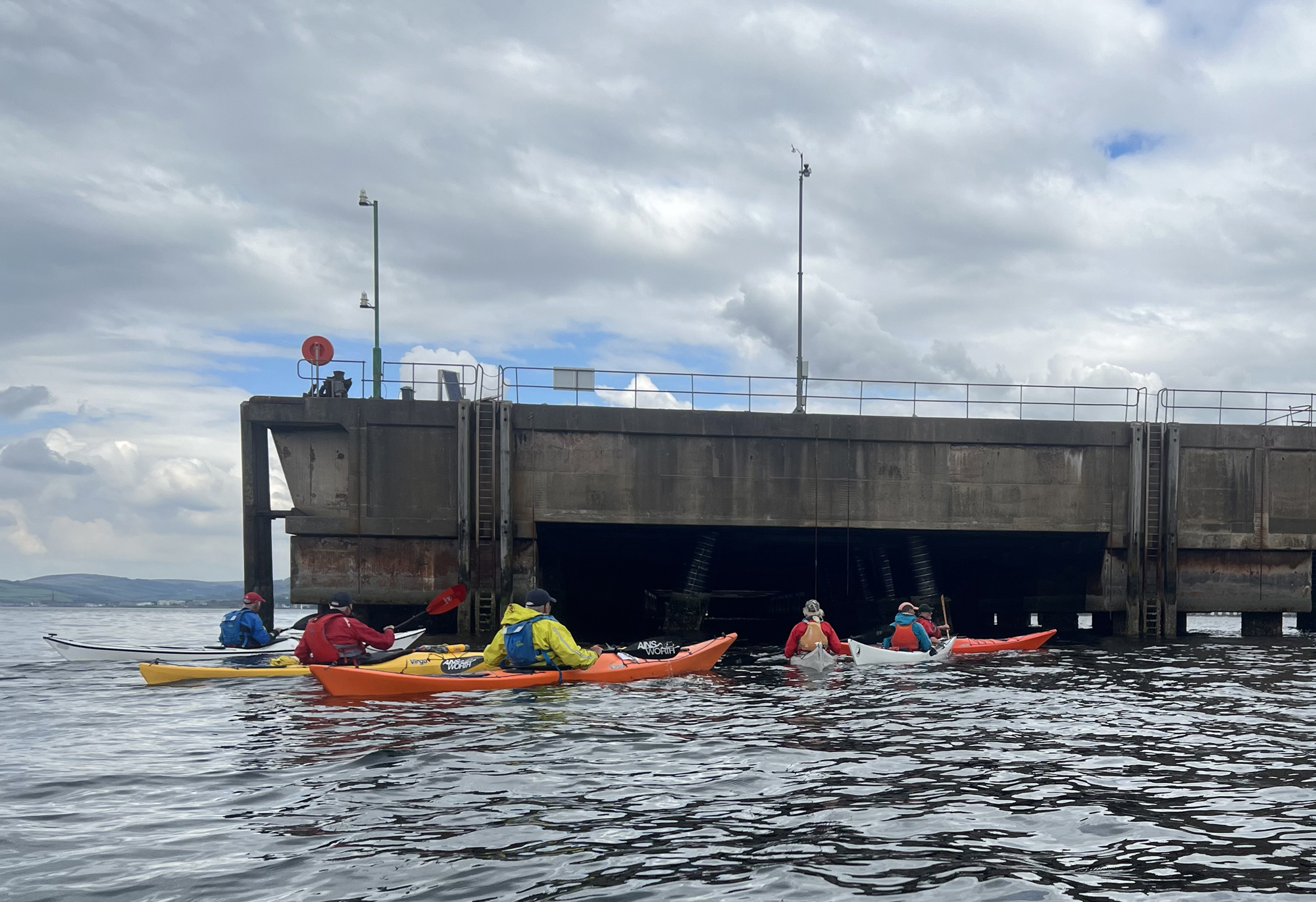
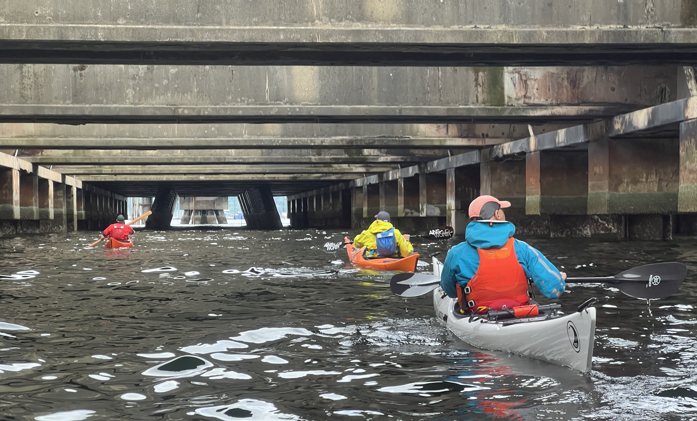
Woke up to find that the weather forecast was correct in predicting sunshine. John gave us a quick demonstration of using a towline before we headed off to the Marina again. This time we headed straight across the Fairlie Roads, for an anti-clockwise circumnavigation of the Great Cumbrae Island. Under the Jetty at the Water Sports Centre and a wait to allow the Ferry to depart. Annette resisted the temptation to surf on its wake. I could get used to kayaking in the sun. We rounded the north of the island, past the Tomont End Monument. This erected by the Captain and crew of HMS Shearwater to commemorate two young midshipmen, Charles Cayley and William Jewell, who were drowned when their small sailing boat overturned when caught in a squall on 17th May 1844. The swell seemed to increase as we kayaked down the coast, to the welcome of Fintray Bay Cafe. Here cyclists and kayakers are served through a hatch, not allowed inside as they might get the floor muddy! We closed ranks to go round Portachur Point (shallows & under water dykes) and into Millport Bay. In geology, a dyke is a sheet of rock that is formed in a fracture of a pre-existing rock body. Several of these dyke rock formations have become popular with tourists, including Crocodile Rock, Indian’s Face, Lion Rock and a profile of Queen Victoria’s Face. The Victorian seaside resort of Millport awaited our arrival. The Museum (housed in the former Garrison) was visited. Mainly for its ice cream, cafe and toilets, rather than for its exhibits. Back on the water, we passed extensive sea defence construction (climate change?) and the painted crocodile. A detour around The Eileans (two small Islands) to see the seals and on to Farland Point. We closed ranks to go round the Point (shallows & under water dykes) and continued north along the coast to the rock in the shape of a lion (those dykes again). The tide had turned and the wind had changed direction. We paired up to cross the Fairlie Roads (keeping a lookout for any shipping) and headed for the Conveyor Pier. In the not so distant past, imported coal was conveyed from the docked ships to trains and thus delivered to power stations around the country. We had other uses in mind for the derelict pier. A surreal journey in semi-darkness, through shafts of light casting strange reflections on the water’s surface, under crumbling concrete to exit past a giant concrete octoped. We hugged the coast, past a moored foreign ship whose crew seemed a little concerned by our presence. Perhaps they thought that we were GREENPEACE. At least they departed pretty rapidly when we left. A brief wait at the Marina entrance, to make sure that no yachts were leaving and back to our slippery slip-way.
Thanks to Annette for organising the trip, to Annette and John for your leadership and to everyone for your support, advice and company.
Tony
